Fisheries GIS Analysis
Fish Passage Design, Construction and Monitoring
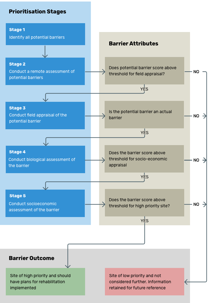
Using GIS analysis, field appraisal and various biological, social and economic metrics, AFPS can carry out a barrier prioritisation in your region, to guide funding to the greatest impact sites. Ensuring suitable investment strategies and construction techniques for fish barrier remediation is crucial for ensuring maximum productivity benefits. AFPS has successfully developed investment plans based on the rapid assessment of potential barriers in catchments in Australia and S.E. Asia.
Stage 1
Using GIS software AFPS identifies all potential barriers.
Stage 2
Using GIS programming, AFPS analyses the potential barriers and ranks them according to stream order, catchment condition, location from estuary, fish habitat to be gained from remediation, and the presence of downstream barriers.
Stage 3
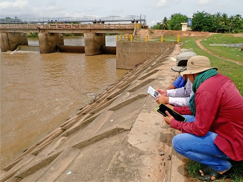
AFPS field validates the top-ranking barriers from Stage 2 to confirm barrier status and to collect important barrier information including type, dimensions, headwater and tailwater levels, condition and use and site access.
Stage 4
Conducting a biological assessment of the barrier, AFPS gathers information including the stream condition, water supply and quality and upstream fish habitat.
Stage 5
Conducting a Socio-economic assessment of the barrier, allows AFPS to consider the costs associated with barrier remediation, design and constructability issues, remediation effectiveness and productivity benefits.
The outcome of this Barrier Assessment Procedure is the generation of a Barrier Prioritisation List so that funding may be directed to the most important barriers first.
Barrier Assessment Procedure